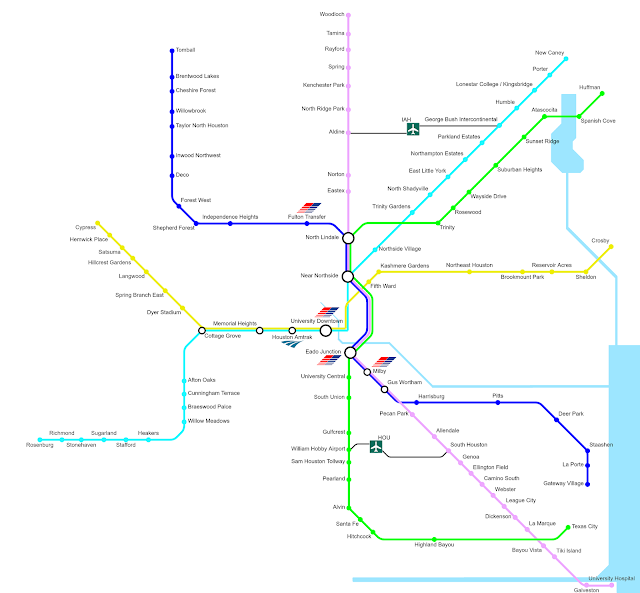
Houston's Amtrak station is served by the yellow and cyan lines, and all lines have transfers to the light rail system at at least either University Downtown or Eado Transfer, as indicated by the MetroRail icons [I added an additional light rail station at Fulton transfer]. This time, I did build in shuttle buses to connect Houston's two airports to nearby rail lines.
Lines
- Blue: 57.7 miles, 22 stations
- Cyan: 66.3 miles, 26 stations
- Yellow: 46 miles, 18 stations
- Lavender: 82.2 miles, 28 stations
- Green: 73.3 miles, 23 stations
Houston's downtown with the light rail connections is so busy, I've only included the MetroRail lines on special map detail.
From high above, Houston's rail system looks something like a great clock with the downtown at the center and a number of straight lines emanating in many direction. This made the the pure-45-degree schematic somewhat distorting, forcing substantial errors in either relative distance or curves and straightness of the line.


No comments:
Post a Comment