Tuesday, October 27, 2015
Orlando
Orlando could conceivably be considered an extension to the Tampa system, but instead is presented as its own system, with a connection to Tampa's regional rail at Lakeville. In addition, it provides connections to four Amtrak stations, plus the airport (via a shuttle).

Tuesday, October 20, 2015
Minneapolis - St Paul
The Twin Cities of Minneapolis and St Paul house the capitol building along with two-thirds of all Minneapolis residents in their metro area. A light rail line has connected Minneapolis with the airport since 2004, and a second linked the two downtowns a decade later. Minneapolis is also linked to its northwestern suburbs by the Northstar Commuter Rail. But for such a large city with fairly thorough existing rail property, more is possible.
South of the Savage / Port Cargill area, there's a right-of-way which is intact, but definitely lacking any hardware. If we're rebuilding anyway, I've decided to make that a feeder Bus Rapid Transit line, connecting Lakeville to a new transit center at Savage.
South of the Savage / Port Cargill area, there's a right-of-way which is intact, but definitely lacking any hardware. If we're rebuilding anyway, I've decided to make that a feeder Bus Rapid Transit line, connecting Lakeville to a new transit center at Savage.
Wednesday, October 7, 2015
Nashville
In Tennessee's capital, we've come across a city with an existing commuter rail system: the oft-maligned Music City Star. As I built my system out, it seemed that this existing route was laid through one of the less populated rail corridors available, which probably goes to show there's more to making a network than looking where there's existing train tracks.
The station spacing on the Music City Star to Lebanon is far wider than the 1 to 3 miles I typically use. This may be due to the sparser population to the east, or that this (and as we'll see with other upcoming cities with existing heavy rail) is more of a "park-and-ride" system, whereas mine are design to support/encourage walkable communities around the stations.
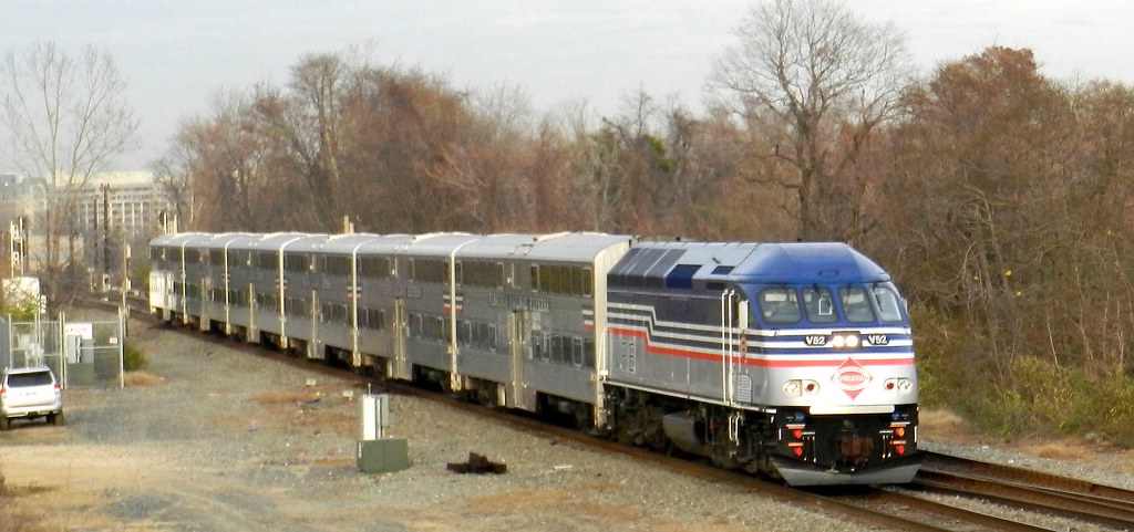
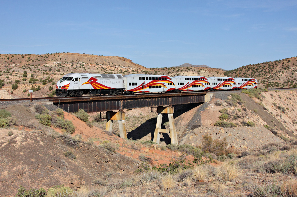
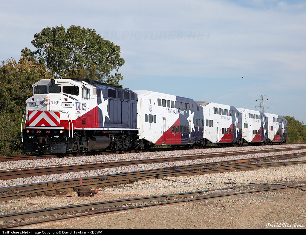
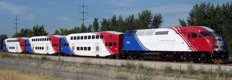
We now also have an idea as to what rolling stock might be used: a diesel locomotive with a couple of double-deck cars behind.

from Peepersk
This in fact is an incredibly popular decision, it turns out, for isolated commuter rail systems. The Nashville Star, Virginia Railway Express, New Mexico Rail Runner, Minneapolis Northstar, Dallas Trinity, Florida TriRail, Utah Frontrunner, and Seattle Sounder all have something similar. I've always been planning on using diesel, since I don't expect cities to install catenaries. But for the closer-spaced stations, I think DMUs (like Austin or Denmark) would work better.
The station spacing on the Music City Star to Lebanon is far wider than the 1 to 3 miles I typically use. This may be due to the sparser population to the east, or that this (and as we'll see with other upcoming cities with existing heavy rail) is more of a "park-and-ride" system, whereas mine are design to support/encourage walkable communities around the stations.
We now also have an idea as to what rolling stock might be used: a diesel locomotive with a couple of double-deck cars behind.

from Peepersk
This in fact is an incredibly popular decision, it turns out, for isolated commuter rail systems. The Nashville Star, Virginia Railway Express, New Mexico Rail Runner, Minneapolis Northstar, Dallas Trinity, Florida TriRail, Utah Frontrunner, and Seattle Sounder all have something similar. I've always been planning on using diesel, since I don't expect cities to install catenaries. But for the closer-spaced stations, I think DMUs (like Austin or Denmark) would work better.




Lines
- Green: 62.4 miles, 26 stations
- Purple: 23.4 miles, 13 stations
- Red: 41.2 miles, 22 stations
- Yellow: 22.7 miles, 11 stations
- Music City Star: 31.1 miles, 6 stations
Friday, October 2, 2015
Richmond
Virginia's capital has a metropolitan population of just over a million. It is well-served by Amtrak, but lacks any regional rail system; the Virginia Railway Express to Washington ends 60 miles to its north. This Dreamed-Of system provides connections to three Amtrak stations and even a walking-distance link to the airport.
Lines
- Orange: 20.7 miles, 13 stations
- Purple: 29.9 miles, 17 stations
- Yellow: 17.7 miles, 10 stations
- Cyan: 19.7 miles, 11 stations
- Green: 41.7 miles, 19 stations
Tuesday, September 29, 2015
Birmingham
Alabama's largest city, Birmingham currently doesn't have any rapid transit system (though a downtown streetcar has been proposed). The metro area population of over 1,100,000, with large population spread throughout the connected regional towns. The dreamed-of system has five lines which converge on the downtown station, which also provides connection to Amtrak with service to New Orleans, Atlanta, Washington, and New York.
Lines
- Yellow: 39.8 miles, 17 stations
- Red: 24.5 miles, 15 stations
- Cyan: 29.2 miles, 14 stations
- Violet: 18.5 miles, 11 stations
- Orange: 42.3 miles, 19 stations
Wednesday, September 23, 2015
Tampa
The Tampa Bay Area, including Tampa, Clearwater, and St Petersburg, is home to over 4 million people, and represents another colossal urban complex without any existing rapid transit (barring the heritage TECO streetcar line). Its six lines provide connections to two Amtrak stations, as well as the Orlando regional rail system (coming soon).
Lines
- Light Blue: 77.8 miles, 29 stations
- Orange: 56.2 miles, 16 stations
- Green: 47.9 miles, 12 stations
- Navy: 14.8 miles, 10 stations
- Lavender: 59.5 miles, 14 stations
- Yellow: 59.8 miles, 19 stations
Monday, September 14, 2015
Houston
Houston is the largest city I've tackled with over 6 million people in the metropolitan region, which really means it's the largest in the country without a major metro system. This is changing however, with its first light rail line in 2013, and two smaller routes opening earlier this year. The extensive existing train tracks also made for an impressive dreamed-of system, with five lines and over 100 stations.
Houston's Amtrak station is served by the yellow and cyan lines, and all lines have transfers to the light rail system at at least either University Downtown or Eado Transfer, as indicated by the MetroRail icons [I added an additional light rail station at Fulton transfer]. This time, I did build in shuttle buses to connect Houston's two airports to nearby rail lines.
Houston's Amtrak station is served by the yellow and cyan lines, and all lines have transfers to the light rail system at at least either University Downtown or Eado Transfer, as indicated by the MetroRail icons [I added an additional light rail station at Fulton transfer]. This time, I did build in shuttle buses to connect Houston's two airports to nearby rail lines.
Lines
- Blue: 57.7 miles, 22 stations
- Cyan: 66.3 miles, 26 stations
- Yellow: 46 miles, 18 stations
- Lavender: 82.2 miles, 28 stations
- Green: 73.3 miles, 23 stations
Subscribe to:
Posts (Atom)